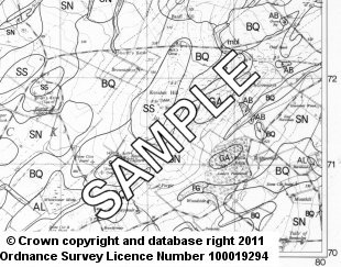
Macaulay Maps - Soil Maps Uncoloured 1:25 000 20x10 KM
MacaulayMaps is a new service supplying maps and related publications that are available from The James Hutton Institute. We offer a series of soils maps and climate, forestry and agricultural suitability maps, at various scales.
Maps can be ordered online by clicking "add to cart" next to the chosen product. Maps are paid for using your credit/debit card or PayPal account.
Please note that digital version of the paper maps are not available for download or purchase, however the digital data which forms the map content (e.g. Land Capability or Soils data) is available to from the Scotland's Soils website under an Open Data licence.
General enquiries are available via e-mail
More information and ordering details are available from: David Donnelly Tel: 01224 395265.
Soil Maps Uncoloured 1:25 000 20x10 KM
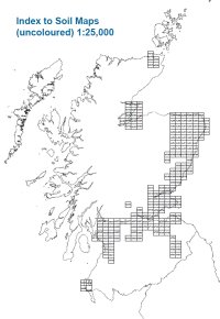
These sheets are published on OS Pathfinder base maps on a 20km x 10km format. They are produced to order as reprographic prints. An index of the map areas can be found below (click to enlarge). Maps at 10km x 10km are also available.
Price (GBP): 43.20 (includes postage)
| Area | |
| NH 76/86 Cromarty | |
| NH 87/97 Hill of Fearn | |
| NH 95/96 Auldearn & Culbin | |
| NJ 81/91 Dyce | |
| NS 46/56 Glasgow (west) | |
| NS 47/57 Milngavie | |
| NS 67/77 Cumbernauld & Kirkintilloch | |
| NS 84/94 Lanark | |
| NS 85/95 Carluke & Forth | |
| NS 86/96 Bathgate | |
| NS 87/97 Falkirk (south) | |
| NS 88/98 Falkirk (north) |


